What Determines Whether Planning Permission Can Be Obtained for Land in Wolverhampton?
There is no single test that confirms whether planning permission will be granted.
Instead, local planning authorities assess a combination of planning policy, location, sustainability, access, technical constraints, environmental impacts and whether the proposed development would represent an appropriate form of growth.
In general, land is more likely to have planning potential where it adjoins an existing settlement, is close to services and facilities, can be accessed safely and can be developed without unacceptable harm to neighbours, the highway network, heritage, ecology, landscape character or flood risk.
Factors such as housing need, five-year housing land supply, settlement boundaries, Local Plan allocations, access to the public highway, public transport, schools, shops, utilities, flood risk and environmental constraints can all influence whether planning permission may be achievable.
Planning policy is particularly important. Land that helps meet housing or employment needs, supports sustainable growth or performs well through a Local Plan review may have better prospects than land that conflicts with strong policy constraints.
Every site is different, and no single characteristic guarantees planning permission. However, sites that perform well across a range of planning considerations are generally more likely to be viewed as suitable candidates for a planning application or future Local Plan promotion.
Understanding how these factors apply to your land is often the first step in determining whether planning permission may be achievable, whether the land should be promoted through the Local Plan process, or whether specialist advice should be obtained before investing significant time and money.
Land is often more likely to secure planning permission where it benefits from several favourable characteristics
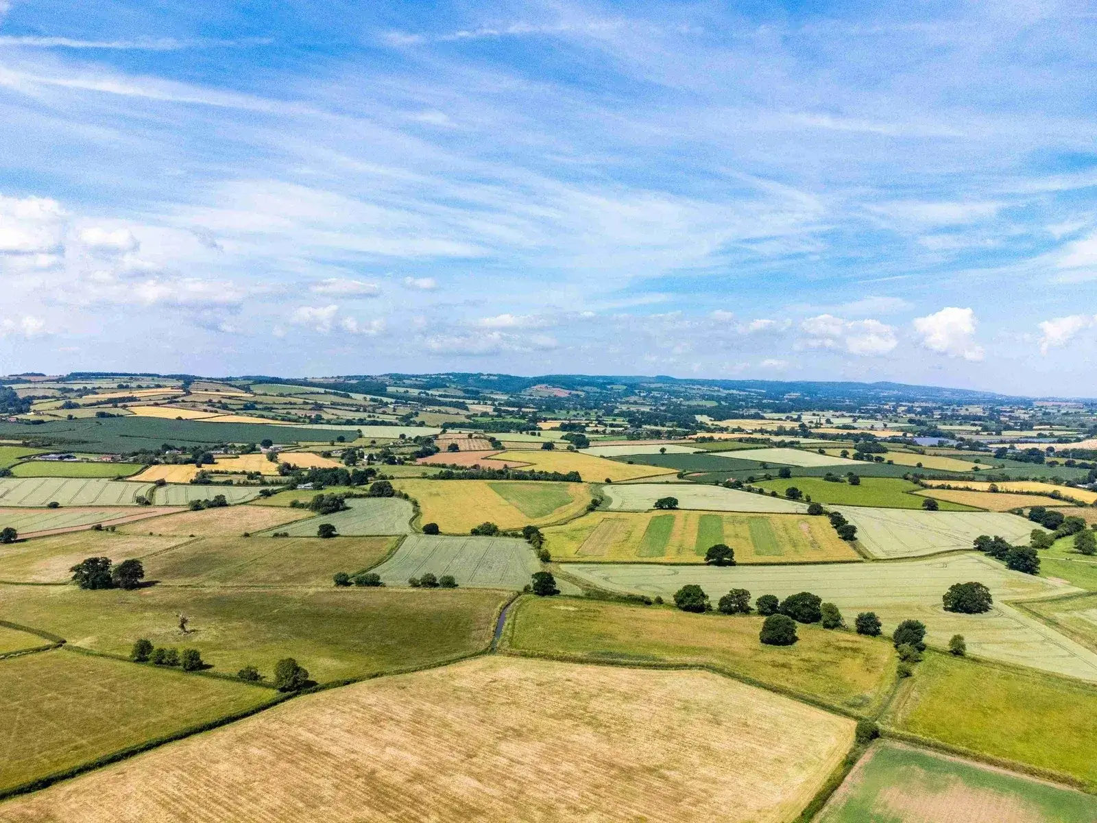
Location is the Starting Point
When considering whether planning permission may be possible, location is usually the starting point.
Land adjoining an existing town, village or built-up area is generally more likely to be considered favourably than an isolated countryside site, because it can often be integrated more easily with existing communities, roads, services and infrastructure.
Planning authorities usually seek to direct growth towards sustainable locations where future residents can access day-to-day facilities, employment opportunities, schools, healthcare, open space and public transport without excessive reliance on private vehicles.
Sites on the edge of existing settlements can therefore offer stronger planning potential than remote sites, particularly where they can help meet local housing or employment needs and can be designed as a logical extension to the settlement.
While location alone does not guarantee planning permission, it remains one of the most influential factors when assessing whether land may be suitable for development.
Sites with stronger planning prospects may be:
Planning Policy and Local Plans Matter
Even a well-located site must be considered within the context of planning policy.
National and local planning policies help determine where development should take place, what type of development may be supported and which sites should be protected from inappropriate development. As a result, the policy position of your land can have a major influence on whether planning permission may be possible.
Key considerations include whether the land sits inside or outside a settlement boundary, whether it is allocated or safeguarded, whether it is affected by Green Belt, countryside, landscape or heritage policies, and how it performs against the adopted and emerging Local Plan.
Planning authorities will also consider housing and employment land requirements, infrastructure capacity, sustainability credentials, design quality, deliverability and the ability of the site to contribute towards future growth needs.
Importantly, planning policy is not static. Local Plans are reviewed, housing requirements change, Call for Sites exercises open and new opportunities can emerge. Land that is not currently allocated may still have potential through a future Local Plan review, planning application or appeal strategy.
For this reason, understanding both the current planning position and the future policy direction is essential when assessing whether planning permission may be achievable.
Key considerations often include:
Settlement Boundaries
Land inside settlement boundaries will generally enjoy stronger policy support.
However, sites outside settlement boundaries should not automatically be discounted.
Many successful developments are delivered beyond existing boundaries.
Local Plan Reviews
Emerging Local Plans can create opportunities where none previously existed.
Authorities regularly review growth requirements and identify new locations for development.
Housing Need
Areas facing significant housing pressure may be more receptive to sustainable development proposals.
Planning Permission for Land in Wolverhampton
Land in Wolverhampton can vary significantly in planning potential depending on location, access, policy status and whether the site relates well to existing settlements and infrastructure.
Wolverhampton sits within the West Midlands planning and property market, where development opportunities may include edge-of-settlement land, brownfield land, garden land, redundant commercial sites, paddocks, agricultural land and larger strategic holdings.
City of Wolverhampton Council has been preparing a new Wolverhampton Local Plan to guide development to 2042 following the end of work on the former Black Country Plan. The Wolverhampton Local Plan reached Regulation 19 consultation in late 2024 and was submitted for examination in December 2025, with examination activity continuing in 2026. The Council has also indicated that further plan-making under the new system may need to commence. Landowners should therefore consider both the submitted plan and any future review work, particularly for brownfield regeneration, urban edge land, employment sites and Green Belt or Grey Belt opportunities.
Wolverhampton contains urban redevelopment opportunities as well as urban fringe and Green Belt-related land around areas such as Tettenhall, Wednesfield, Bilston, Penn, Bushbury, Oxley, Finchfield, Compton and nearby settlements including Codsall, Perton, Essington and Wombourne. Planning potential may be influenced by the city’s local plan work, the wider Black Country planning context, access to transport corridors, neighbouring uses, Green Belt policy and the ability to deliver sustainable growth.
Sites close to existing housing, schools, shops, employment areas, public transport and established services will generally have stronger sustainability credentials than isolated countryside sites. However, each site needs to be assessed on its own merits, including constraints, access, landscape, ecology, flooding, heritage and deliverability.
Areas Around Wolverhampton Where We Assess Land
- Tettenhall
- Wednesfield
- Bilston
- Penn
- Finchfield
- Bushbury
- Oxley
- Fallings Park
- Bradmore
- Compton
- Codsall
- Perton
- Essington
- Willenhall
- Coseley
- Sedgley
- Darlaston
- Walsall
- Dudley
- Tipton
Housing Land Supply can Influence Planning Decisions in Wolverhampton
One of the most important planning considerations is whether the local planning authority can demonstrate a sufficient supply of deliverable housing land.
National planning policy places significant emphasis on meeting housing needs. Where a council cannot demonstrate a robust supply of deliverable housing land or is failing to deliver enough homes, additional opportunities can emerge for suitable, sustainable sites.
In these circumstances, the planning balance may shift, and decision-makers may give greater weight to the benefits of new housing, particularly where the site is well located and capable of early delivery.
As a result, land that may previously have faced resistance can sometimes become more attractive from a planning perspective, especially where it is accessible, unconstrained and capable of delivering new homes in a sustainable manner.
A housing shortfall does not guarantee planning permission, but it can become an important material consideration. Understanding the housing land supply position in your local authority area is therefore a key part of evaluating whether a planning application may have prospects.
This is why monitoring housing land supply, delivery performance and Local Plan progress can be extremely important.
Safe Access is Critical to Planning Permission
A site may be well located and benefit from a favourable planning position, but without safe and suitable access, planning permission is unlikely to be granted.
Planning authorities and highway engineers will expect a development site to provide safe and suitable access for vehicles, pedestrians and, where appropriate, cyclists. The ability to connect properly to the public highway is therefore a fundamental consideration.
Access constraints do not necessarily prevent planning permission. In many cases, issues relating to visibility, junction design, road layout, pedestrian links or traffic impact can be addressed through careful design and highway evidence. However, these matters should be assessed early before significant planning costs are incurred.
The availability of access rights can also be important. A site may require access across third-party land, the improvement of an existing entrance, visibility land outside your ownership or the creation of a new access point to facilitate development.
For these reasons, access is often one of the first technical matters investigated when assessing whether planning permission may be achievable. Identifying potential constraints early can help determine whether a site has realistic prospects.
Councils typically consider:
Site Characteristics can Affect Planning Prospects
The physical characteristics of your land can play an important role in determining whether planning permission may be possible.
Factors such as size, shape, topography, existing land use and neighbouring development can influence how easily a site can be developed and the type of scheme it may accommodate. Regularly shaped sites with relatively level ground are often simpler and more cost-effective to develop, although more challenging sites can still be suitable with the right strategy.
Other considerations include trees, hedgerows, watercourses, existing buildings, utilities, rights of way, drainage, ground conditions and neighbouring land uses. These constraints do not necessarily prevent planning permission, but they can affect layout, capacity, costs and viability.
Planning authorities will also consider whether the site can accommodate development in a way that respects its surroundings and delivers a high-quality, functional and sustainable place to live or work.
Every site is unique, and physical constraints must be assessed alongside planning policy, location, access and market demand. Understanding these matters early provides a clearer picture of whether planning permission may be realistic.
Factors commonly considered include:
Shape
Regularly shaped sites are often easier and more efficient to develop.
Topography
Steep gradients can increase development costs.
Size
The size of the site may influence the type and scale of development that can be accommodated.
Existing Features
Trees, hedgerows, watercourses and existing infrastructure can all influence site design.
Environmental Constraints do Not Always Prevent Permission
Landowners often assume that environmental constraints automatically prevent planning permission. This is not always the case.
Many sites contain environmental considerations that must be assessed and managed through the planning process. Issues such as flood risk, protected species, trees, landscape designations, heritage assets, ecology and drainage can influence how a site is developed, but they do not always prevent permission.
In many instances, constraints can be addressed through sensitive design, mitigation, biodiversity net gain, landscaping, drainage design or changes to the development layout. Planning authorities will often balance environmental considerations against the benefits of development, including new homes, affordable housing, employment, infrastructure and local investment.
The presence of a constraint should therefore be viewed as something requiring further investigation rather than an automatic barrier. The key question is whether impacts can be avoided, minimised, mitigated or outweighed by planning benefits.
Early technical advice can identify the significance of constraints and whether the site remains capable of supporting development. As a result, land that initially appears constrained can sometimes have more planning potential than expected.
The key is understanding how these factors can be managed through good planning and design.
Successful developments often address:
Can I Get Planning Permission on Green Belt Land in Wolverhampton?
Green Belt remains one of the most misunderstood planning designations for landowners.
Development within the Green Belt is more tightly controlled, but Green Belt land should not automatically be dismissed. The designation is intended to manage urban growth and prevent unrestricted sprawl, but it does not mean every Green Belt site has no planning potential.
In practice, many local planning authorities review Green Belt boundaries through the Local Plan process to identify land that may be needed for future growth. National planning policy also recognises Grey Belt land, where parts of the Green Belt may make a more limited contribution to Green Belt purposes.
As a result, Green Belt land can still present opportunities, particularly where it is located next to existing settlements, capable of delivering sustainable growth and aligned with longer-term planning objectives.
Every Green Belt site must be assessed on its own merits. However, landowners should not assume that a Green Belt designation means planning permission is impossible. In many areas, Green Belt land continues to be assessed as part of meeting future housing and employment needs.
Potential opportunities can arise where:
Availability and Deliverability Strengthen Your Case
Planning authorities are increasingly focused on whether sites can actually be delivered.
When assessing land for development, planning authorities are not only interested in whether a site is suitable in principle. They also want to know whether the land is available, achievable and capable of being delivered within a reasonable timeframe.
Landowners who are willing to bring land forward can strengthen a site's prospects during a Local Plan review or planning application. Authorities will usually favour sites where there is clear landowner support, no significant ownership barrier and a realistic prospect of implementation.
Deliverability also extends beyond ownership. Councils will consider access, infrastructure, drainage, utilities, environmental constraints, market demand and the financial viability of the proposed development.
A site that appears suitable but cannot realistically be delivered may be viewed less favourably than a site that can make a genuine contribution to housing or employment needs. Demonstrating availability and deliverability can therefore help improve planning prospects.
Sites that are sustainable, available, achievable and deliverable are generally viewed most favourably.
Questions commonly include:
Why Wolverhampton Landowners Often Miss Planning Opportunities
Many landowners assume planning permission is unlikely because:
However, planning circumstances change regularly.
A site that was unlikely to secure permission five years ago may be viewed very differently today.
This is particularly true where housing requirements, Local Plans, settlement strategies, national policy or appeal decisions have changed.
How Planning Permission can Influence Land Value
The value of land is closely linked to whether planning permission can be achieved.
Land valued solely for agricultural, paddock or amenity use will usually command a very different price to land with realistic prospects of planning permission for residential, commercial or mixed-use development. As planning prospects improve, so too can the potential value of the land.
Developers and land buyers are often prepared to pay a premium for sites that have realistic planning prospects. Location, planning policy, housing need, access, constraints, market demand and deliverability can all influence how the market views a site's potential.
In many cases, the greatest increase in value occurs when planning permission is secured. However, land can also become more valuable as it progresses through the planning system, particularly where it is identified through a Local Plan review, promoted through a Call for Sites process or recognised as a potential allocation.
For this reason, identifying planning opportunities is often the first step in unlocking value. A clear understanding of a site's strengths, constraints and planning prospects can help landowners decide whether to pursue planning permission, promote the land, or explore a land promotion agreement.
The greatest increases in land value usually occur where planning permission becomes achievable or is secured.
Possible Routes to Planning Permission for Sites in Wolverhampton
There is more than one way to unlock planning permission or development value. The right route depends on your land, the local planning policy position and the level of evidence needed to support the site.
Planning Application
A direct planning application may be appropriate where the site has strong policy support, limited constraints and a realistic prospect of consent in the short term.
Local Plan Promotion
Where policy support is not yet in place, the best route may be to promote the land through the Local Plan, Call for Sites or site allocation process.
Promotion Agreement
A land promotion agreement can allow a specialist promoter to fund the planning work, manage consultants and seek to maximise land value before sale.
Frequently Asked Questions
How Value My Land Can Help Landowners in Wolverhampton
If you are asking, can I get planning permission on my land in Wolverhampton?, Value My Land can help you understand whether your site has realistic planning potential before you commit to costly surveys, drawings or planning applications. We assess the land, review the local planning context and identify the most suitable route to unlocking development value. We can provide:
Simply send us a postcode, Google Maps pin or site plan for your land in or around Wolverhampton. We will provide an initial no-obligation review, explain the likely planning issues, identify potential opportunities and outline whether the land may be suitable for a planning application, Local Plan promotion, Call for Sites submission or land promotion agreement.